| Welcome to the OSGeo:UK Newsletter |
|
Hello and welcome to the OSGeo:UK newsletter. This newsletter exists to share updates and information every couple of months about the OSGeo:UK local chapter, the OSGeo global organisation and general FOSS for geospatial goodness. Please share the newsletter with anyone you think might be interested - they can sign up too. For now, please enjoy this edition. |
|
Find out more about OSGeo:UK and how you can be part of our community on our website. |
|
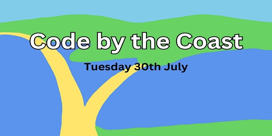
It's rapidly approaching! The UK code sprint on the south coast - Code by the Coast will be held on Tuesday 30th July 2024 at the The Heights Hotel, Portland, Dorset, UK. If you've been wondering how to become involved in the free and open source community but didn't know where to start then come along help create some up and coming open-source projects! There are all sorts of tasks that need completing involving a range of skills: “whether you are new to open-source geospatial development or have been working in the industry for years we hope this event will be the summer work-cation you need!”. Twenty spaces at the event are provided free of charge thanks to OSGeo:UK and Addresscloud but spaces are strictly limited so make sure that you book your tickets now. Addresscloud are big advocates of open source software and strong backers of OSGeo:UK and FOSS4G events. They help insurers understand geographic risk and their award-winning platform provides leading insurers with APIs and applications to make better underwriting decisions. They also do some very cool stuff with DuckDB and geoparquet so checkout their presentations when you get the chance! Be aware that there's an option to help the organisers cover their expenses (and potentially generate a small surplus to go towards future events) if you purchase a “sponsored place” ticket. Next, would you be interested in the global conference coming back to the UK? The last time it was here was in 2013 and it was an amazing experience. If you would like to be involved, then please get in touch by emailing [email protected].
|
|
Projects sponsored by OSGeo:UK |
|
Our annual GoFundGeo mechanism, for the period between the 2023 and 2024 AGMs, has agreed to distribute more than £5500 across seven projects (see the last newsletter or the OSGeo:UK website for the full list). Andrea Ordonselli continues to push forward the development of gis2web with version 3.20 being released in May 2024. The full details of that release can be found here, but some points to note include the fact that OpenLayers related videos are better supported, SVG implementation has been improved and the WIKI documentation has been updated to show the major changes.
As ever, there is a lot of QGIS related news but some things to note include the fact that the Danish User Group has become a Flagship Member alongside organisations such as Felt. |
|
Wider software and event news |
|
As we mentioned in the last newsletter, FOSS4G Europe 2024 is happening between 1-7 July 2024 in the city of Tartu in Estonia. If you want to meet the European open source geospatial community and find out what is happening across various projects then now is the time to book your place at the conference. We also want to remind you that there is a Telegram channel for live discussions with the organisers and participants. Finally, Ian Turton will be bringing FOSS4G:UK and OSGeo:UK stickers to the event, so go find him for interesting conversations and sticker fun.
The flagship international FOSS4G 2024 event is being held between December 1-8, 2024 in Belém, Brazil. As with all FOSS4G events the conference will showcase what is new and exciting in open software and data, and open communities from around the world. And whilst we are talking about the global event, it has been announced that Aukland, New Zealand will be the hosts for the conference in 2025. At a very local scale, despite there not being a national FOSS4G:UK conference this year (remember, you can help make the dream a reality in 2025 by volunteering your time or a venue - just let the OSGeo:UK committee know 😎) there are plans afoot for a small local event in Bristol. Once we have more details we will share them via the OSGeo:UK website and this newsletter. Talking of geospatial conferences, they may not be FOSS4G related but the National Earth Observation Conference and the Association for Geographic Information GeoCon are both happening later this year in the UK (10-12 September in York and 28 November in London, respectively) so you might want to check those out.
|
|
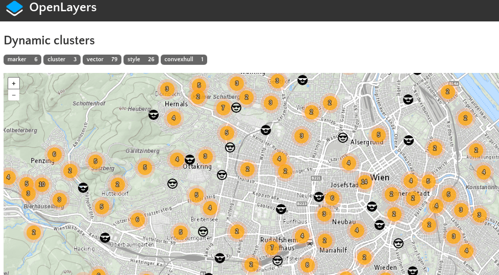
Now for some wider geospatial FOSS news! The OSGeo project deegree has been getting some love and attention at the recent Community Code Sprint held in Germany between 5-7th June. The overall objective, as stated on the associated website for the sprint, was "to finalise the deegree release version 3.6 for Java 17 and Tomcat 10 ... [including] the preparation of the build environment and all steps ... to build the deegree project with Java 17". Deegree itself is server software to create spatial data platforms and includes geo-data management, access, and mapping components, all of which are compliant with open standards. OpenLayers, the web mapping package, has also recently been updated to version 9.2 (although the current version is 9.2.4 after a few bug fixes have been addressed). A full list of the changes made in the 9.2 release can be found online. If you are an OpenLayers user, or are considering the package, now would be a very good time to check out the latest improvements and additions.
That stalwart of the open source geospatial software toolbox, GRASS, has not one, not two but three (!) students helping develop additional functionality as part of Google's 2024 Summer of Code! One project will continue to develop and enhance the integration between GRASS and Jupyter Notebooks, helping to make the GIS software available to a wider array of data scientists and developers. Another will replace outdated libraries for downloading different satellite data sources with a single cohesive workflow on the backend using EODAG. The final project will improve the ability of GRASS to provide machine readable output, with an emphasis on it being in a format easily ingested by Pandas.
And finally, the Geoserver account on Mastodon started an interesting discussion about moving their mailing list to the open source Discourse platform. This is a topic that has been raised on the OSGeo mailing lists (both by the global and UK organisations) and seems to be a route that OpenStreetMap and QGIS either have completed or are considering. If you have strong opinions on any of this then jump on the OSGeo:UK mailing list and let us know.
|
|
We hope that you found this edition of the newsletter interesting and informative. If you have any feedback or comments then let us know! |
|
|
| |
|
|